Start point
Sulfur Springs Trail Camp, mile 406.6
End point
Messenger Flats Campground, mile 430.4
Miles hiked
23.8
Wilderness area
Angeles National Forest
San Gabriel Mountains National Monument
The day on trail

It’s always the spots with rivers that get you. They bring in a cold, wet current of air that’s seems to always bring on the condensation or frost. You’re pretty much guaranteed to wake up with the shell of your bag or quilt damp. But hell, it’s great to have water nearby! Funny enough, though, as great as it is to have water, we seem to rarely use much. We’re so used to conserving that it’s not too big a deal. It’s just so nice to have the option. Your pot gets a little cleaner; you’re just a little more hydrated. It’s less a matter of need and more a matter of conservation.
Today was a push. We wanted to make some miles despite a climb, so it’s going to be the kind of day with intention of moving forward despite exhaustion, you know, a slog.
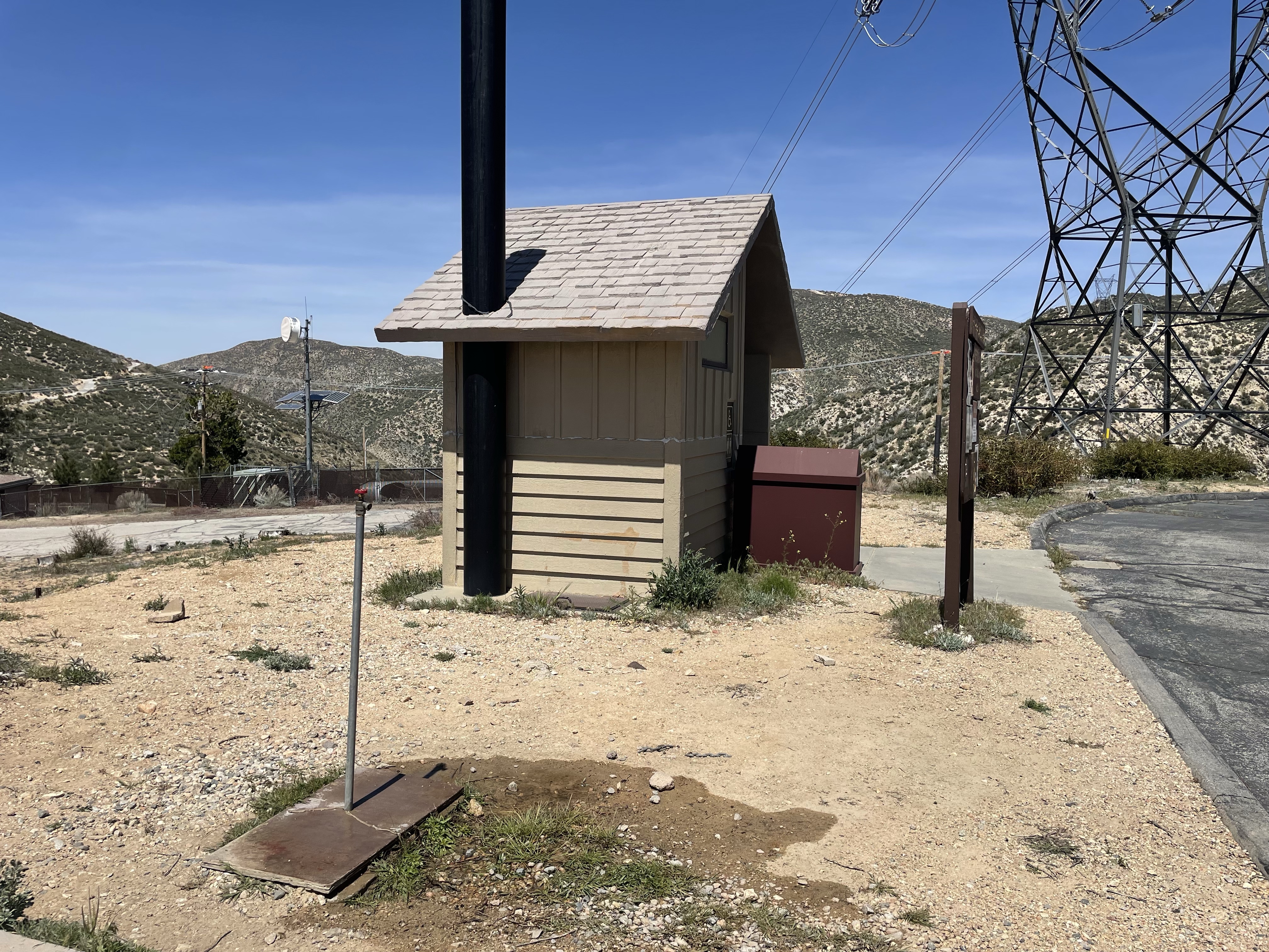
It was a toasty day. There was also terribly much water to be found along the route. The most significant water refill was a group of spigots near a stop for road trips and a local fire station, but that was fairly far away from the ultimate destination.
The morning was a hot slog through ups and downs. It was, frankly, exhausting. There wasn’t much energy left over for photos. It was just making sure one foot got in front of the other as sweat formed a moving sheet of water on my skin and drenched my shirt.
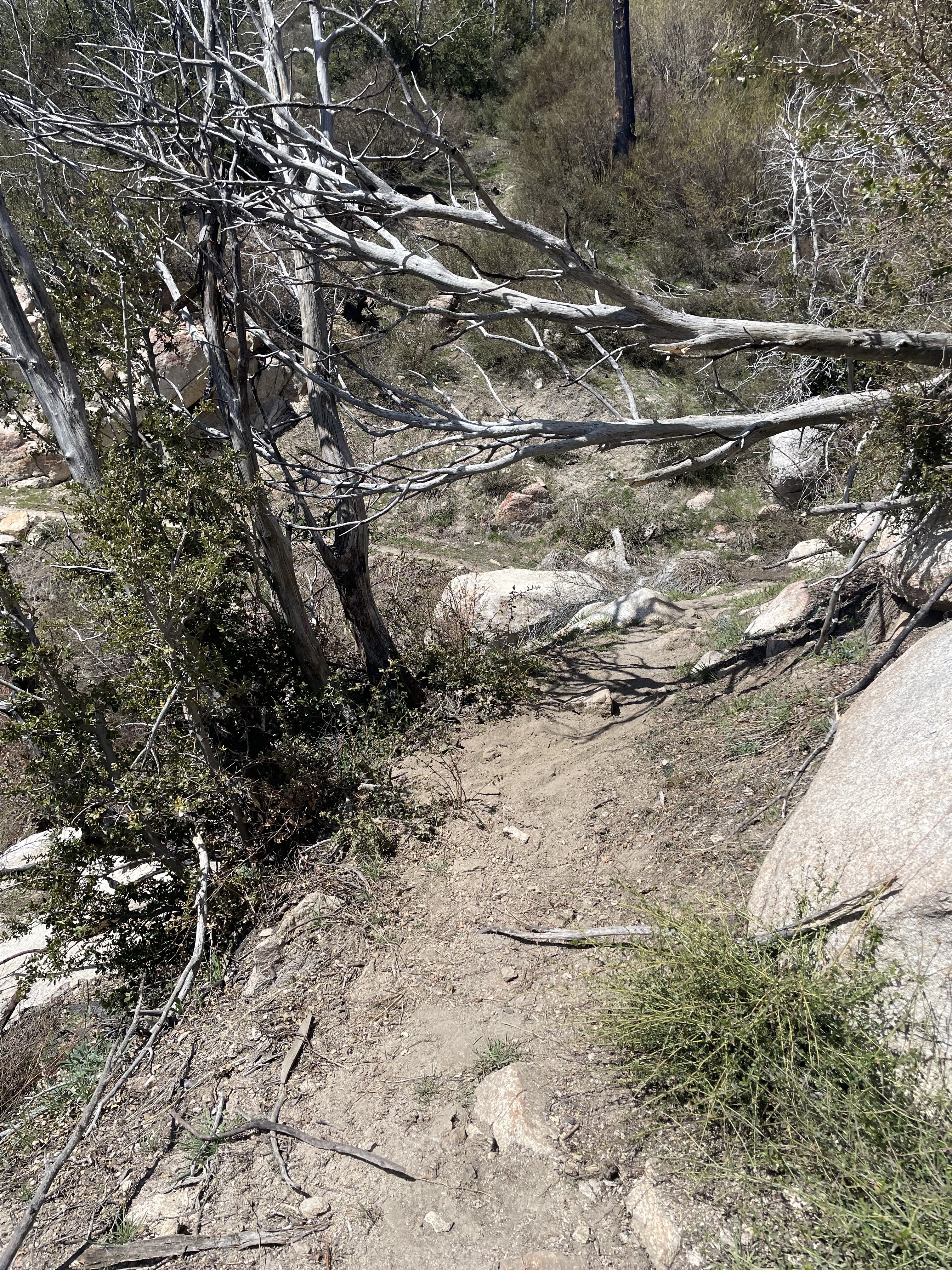
Even though it was hot, I’m still getting better with blowdowns. This is turning into PCT Ninja Warrior and I’m figuring out how to climb on all fours, swing and dangle from my arms, and army crawl under trunks. Washouts are also becoming even easier. It’s just finding purchase for your feet and being confident the ground under you will do what you ask it to.

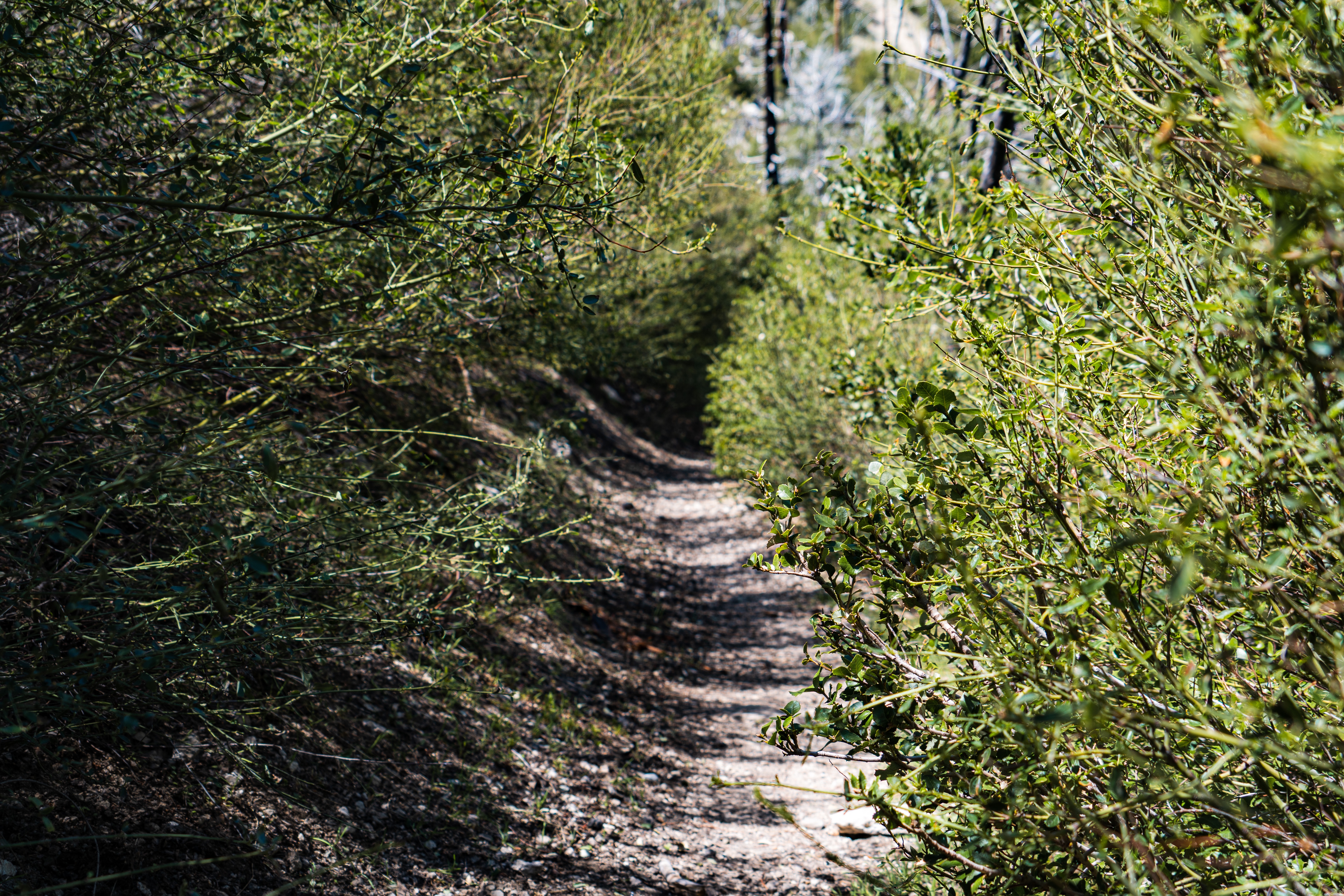
There were some fun spots of scrub brush tugging at your legs, a chewed up plank, and some burn area.


Of course there were still flowers.

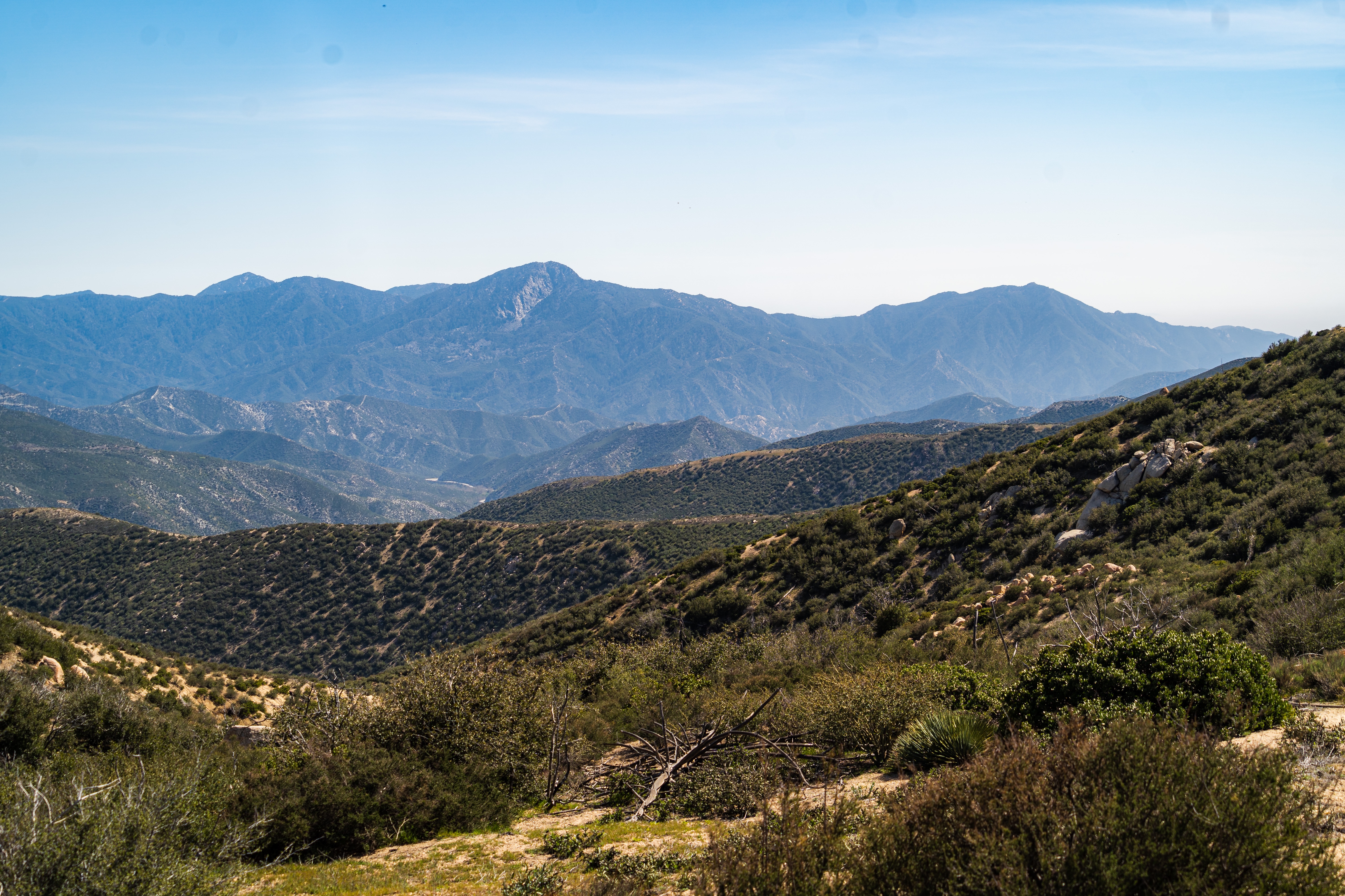
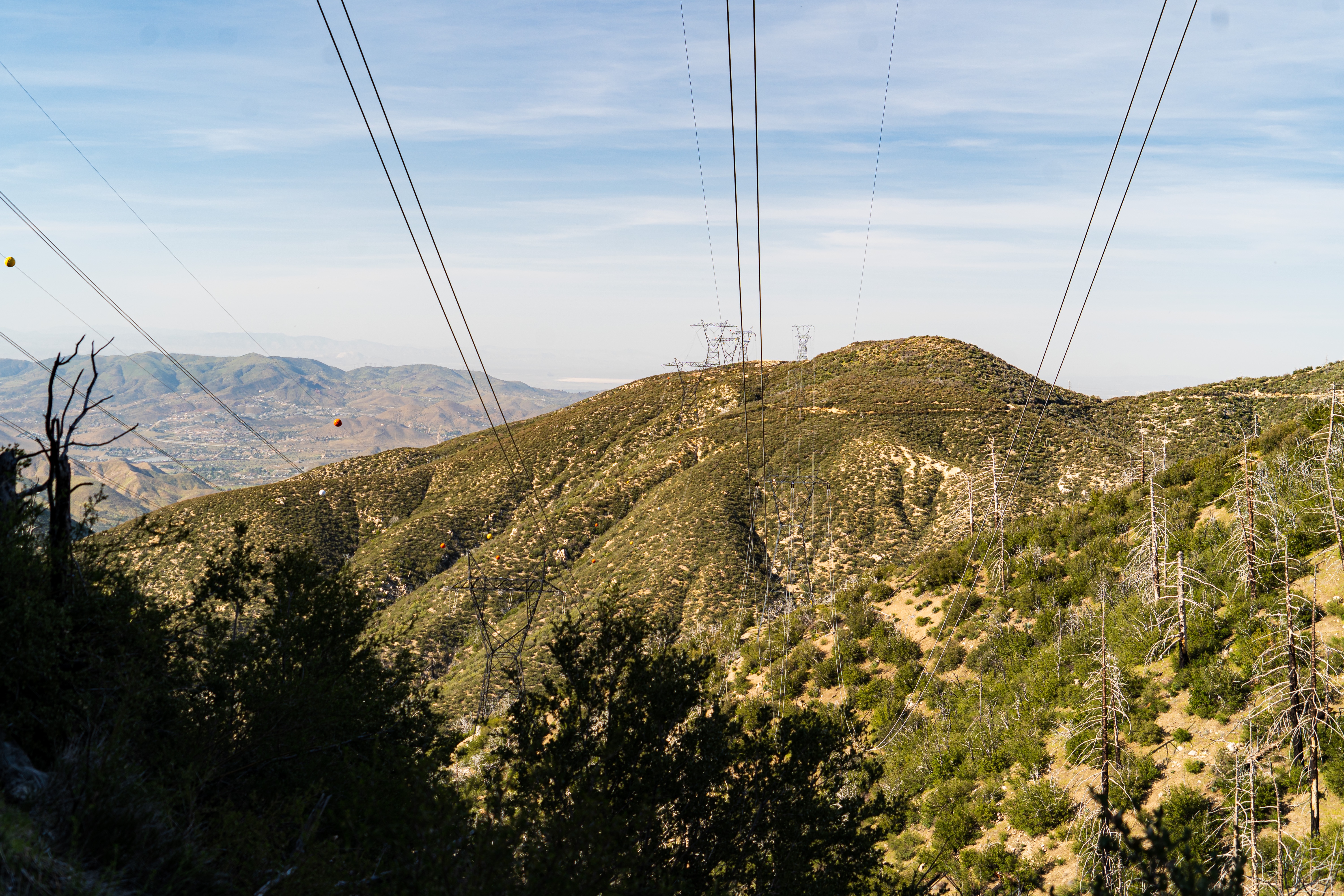
And there were beautiful views, which often comes along with these ups and downs.

There was a nondescript piece of white cardboard by a barely perceptible side trail. It had “water” written thinly in pen. That’s always a good sign, so I followed the trail. It ends up that I accidentally found a picnic table overlooking the fire station and the road monument and had a highly pressurized spigot. I sat down, laid out my food bags, and started to go to town on my peanut butter and tortillas. And of course what I’ve come to call “hikertrash fondue.” It’s when you dip protein bars in peanut butter or Nutella.
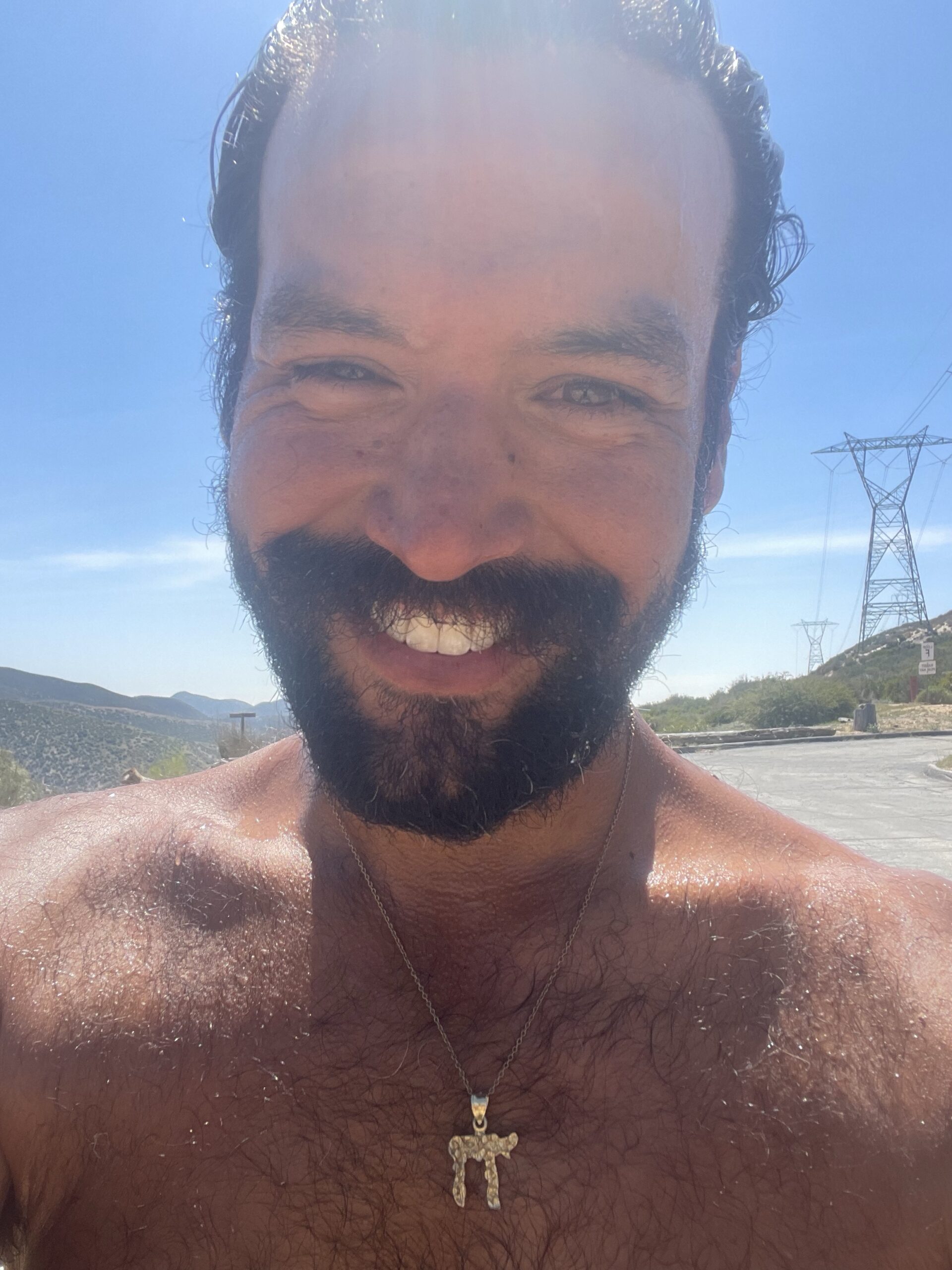
I took a lot of time to filter water and drink a lot, or camel up. I even took a moment to take off my shirt and hat, rinse myself off, and soak the shirt and hat. It was cold and glorious.
El Dorado, Florida Man, Janna, and Cake came by partway through my lunch. They’re starting to open up to me and it’s fun. I’d love to have some more friends out here, rather then just acquaintances. They went down the hill to sit at the slightly sheltered picnic table at the fire station. I was enjoying the sun after drinking up and cooling off.
But it was enough sitting and time to get moving. I was maybe 1/3 of the way to where I wanted to be. But there’s something about how I hike where it seems I go slow, have a good lunch, then just joyfully power through the rest of my miles. I love how it feels to get into my rhythm and crank out miles.
There was yet another burn area. Another reminder of the perennial dangers the landscape faces out here.

More power lines, and these had a buzzing that didn’t put me on alert. It still was just those outside Cajon that did it.
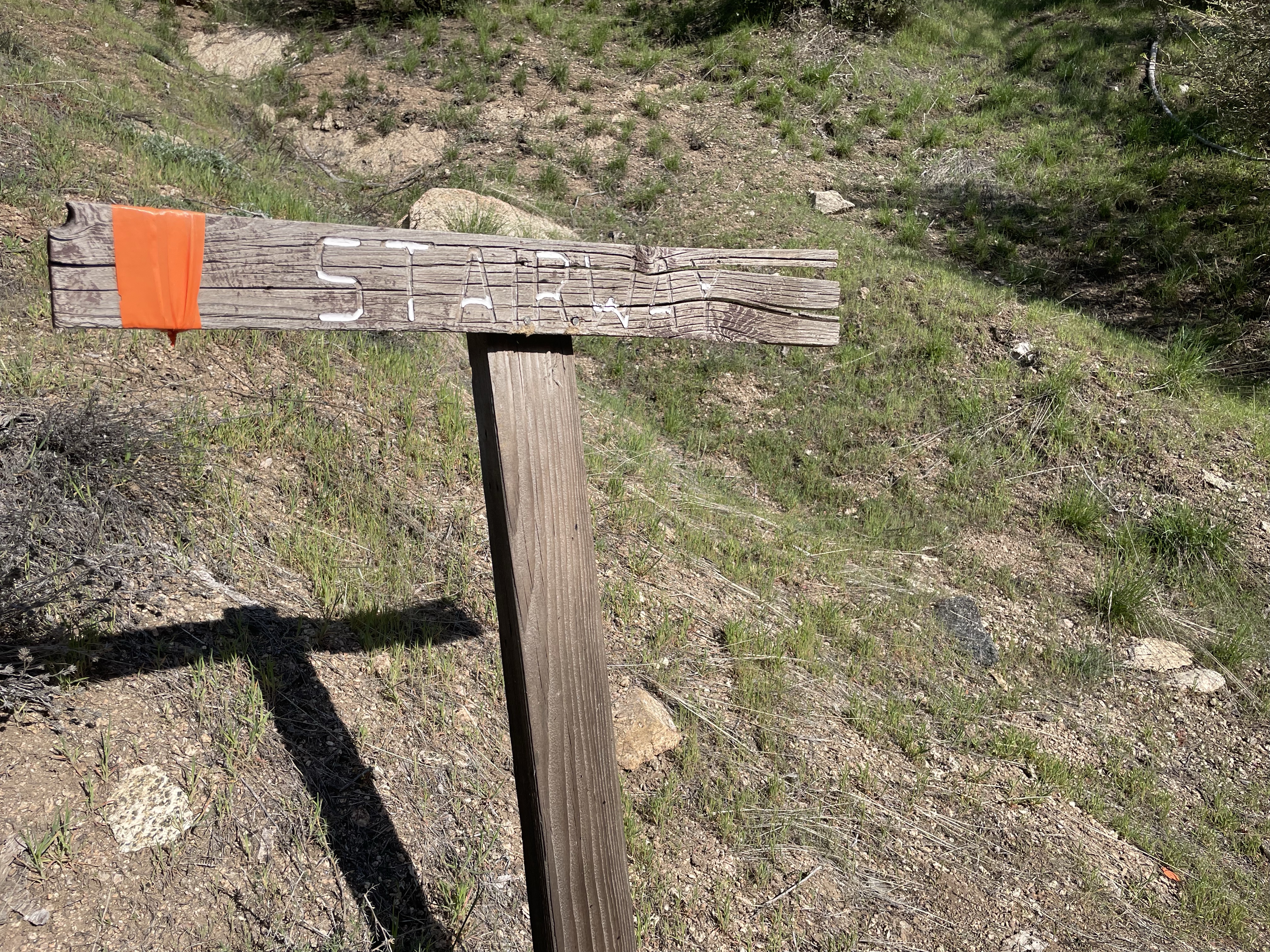
This sign pointed out some stairs, but they were really just a dirt track going up into a saddle.
Getting later in the afternoon, because that’s how time works, I started the final climb of the day. And climbs mean views.

There was a tiny bit of snow off the side of the trail at times. But the real nasty part was near the top. There was an absurd number of blowdowns which hid switchbacks at the top of the mountain. I lost the trail a few times and then finally found it.
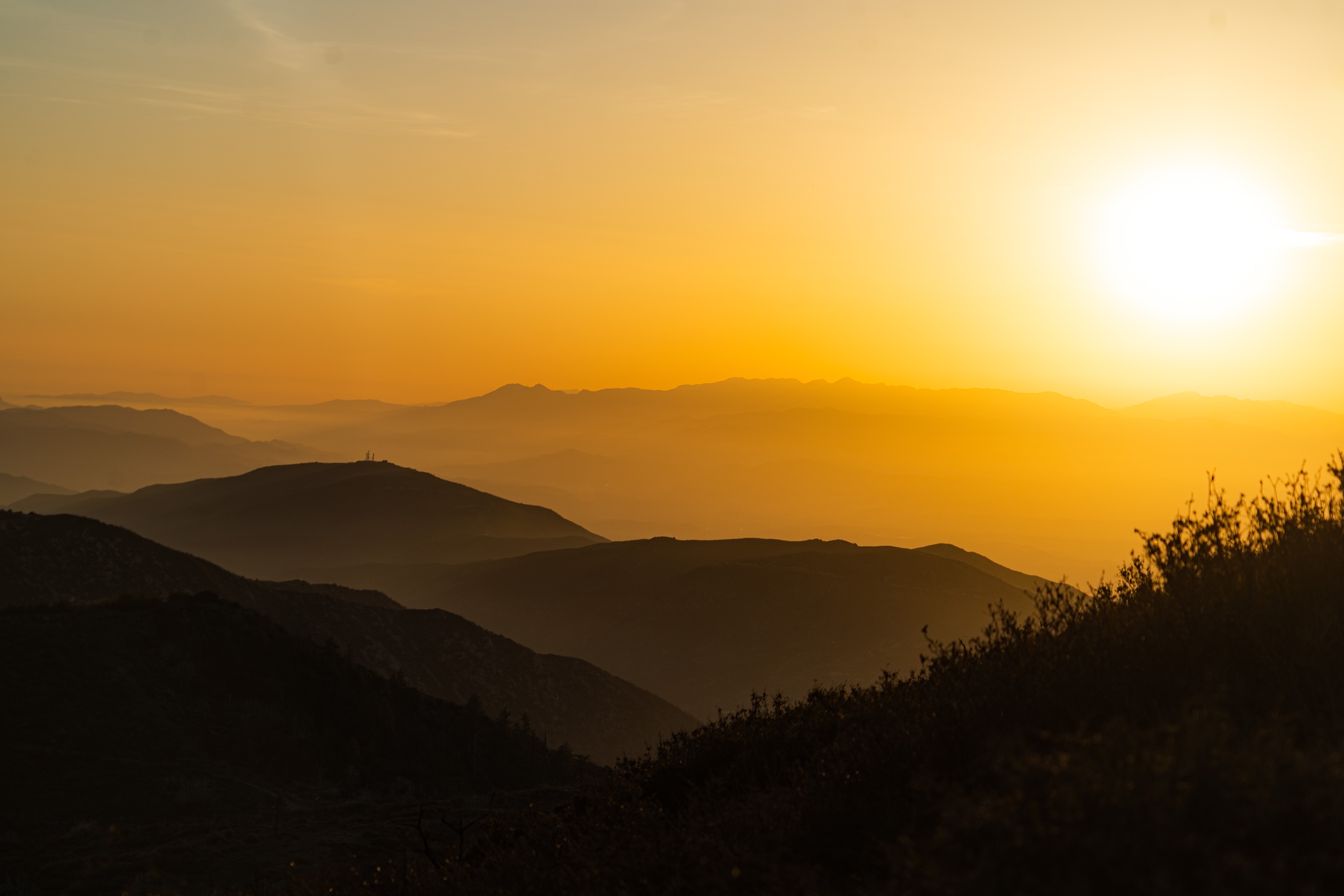
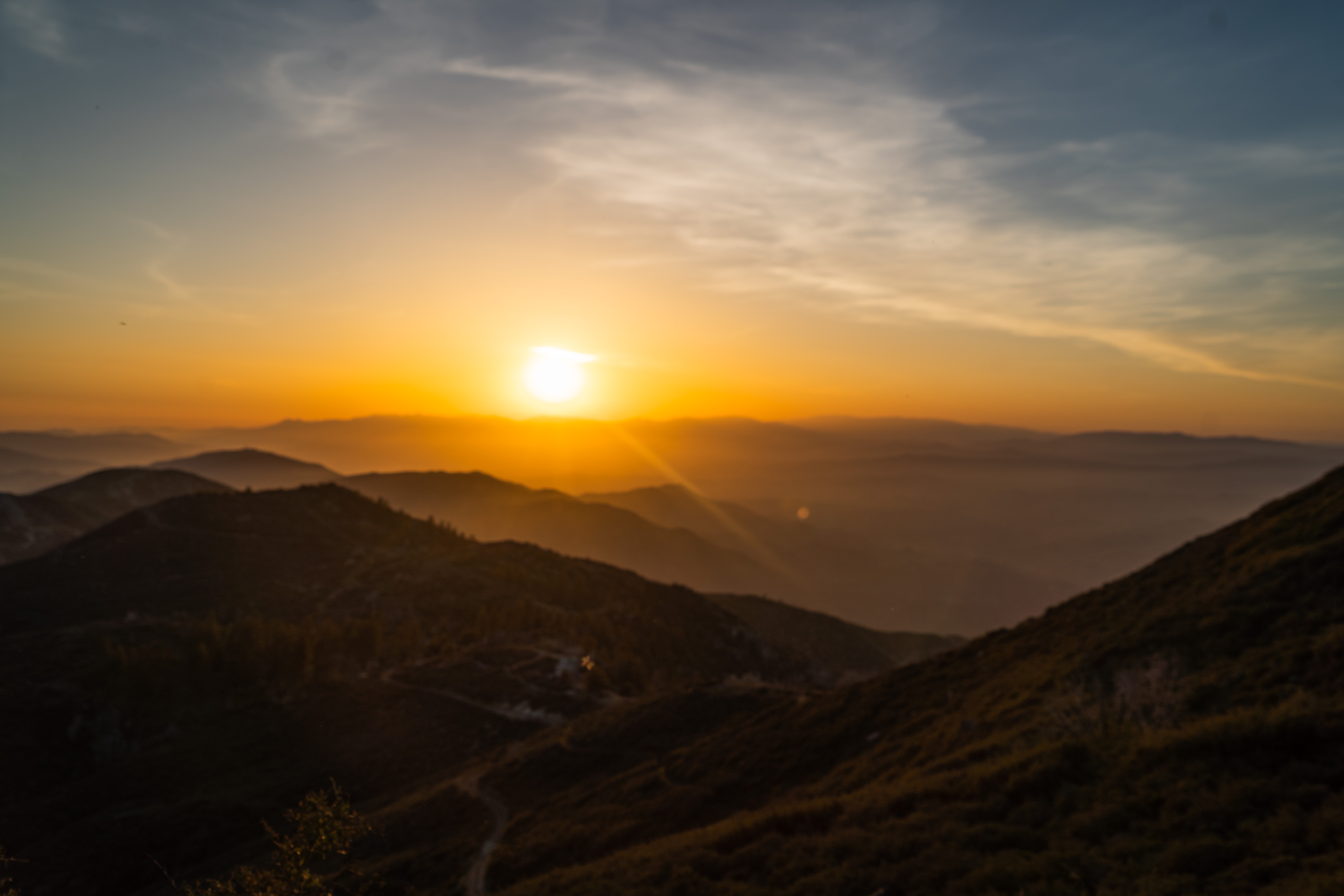
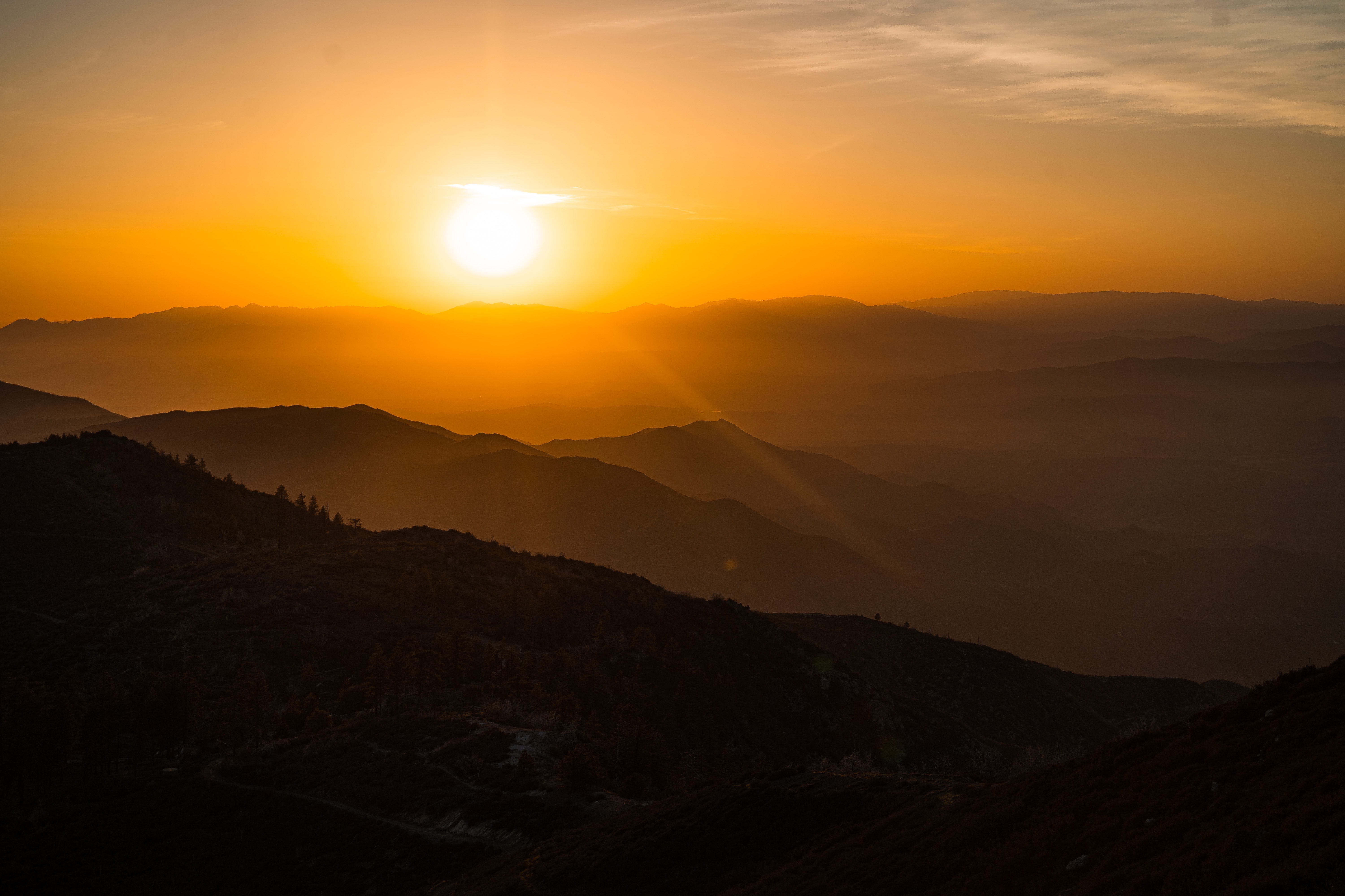
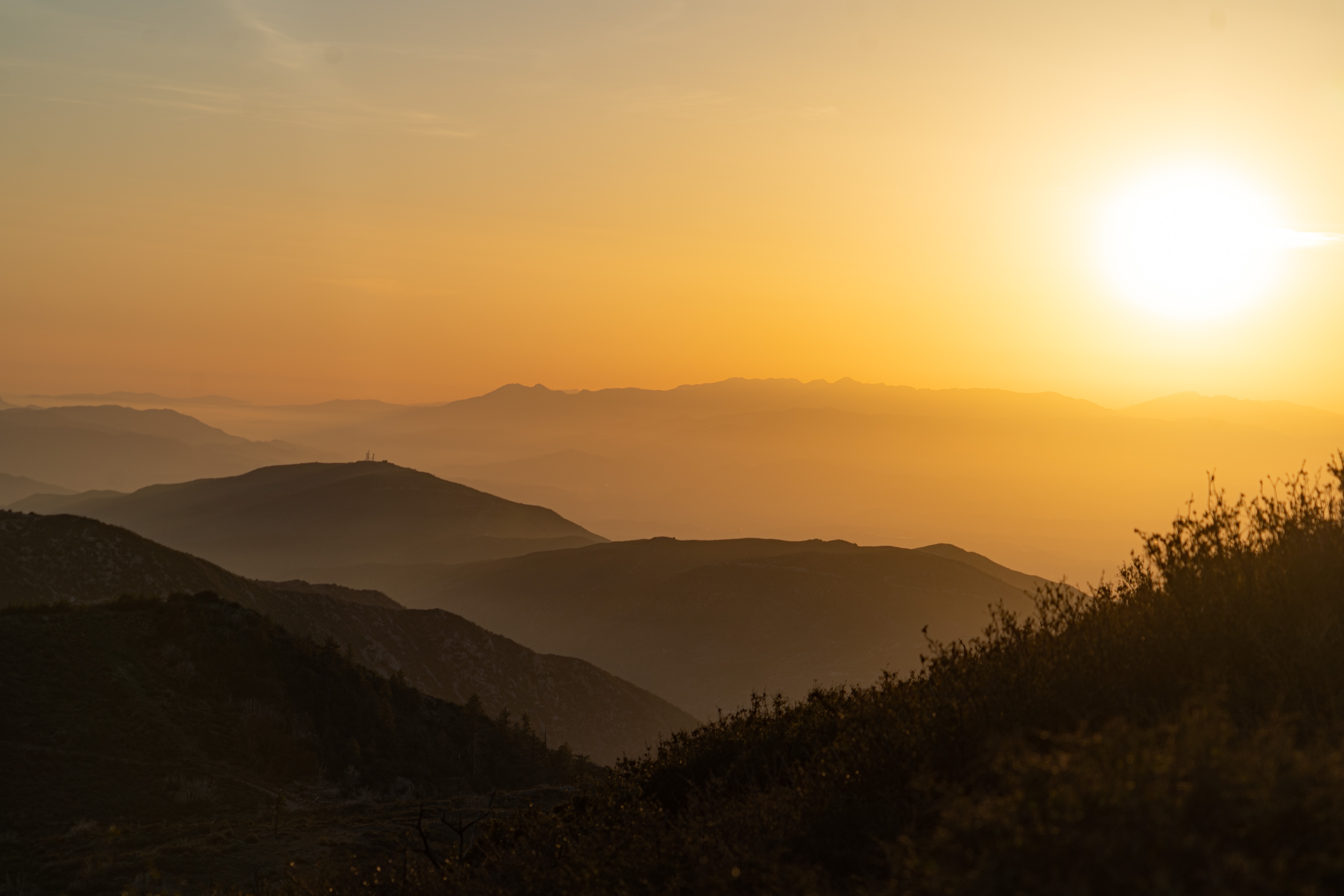
Over the top of the mountain was when the magic happened. There was a bunch of scrub brush and a narrow trail. It was hard to push forward because the bushes pushed back and you had to press through and around them, all while navigating not just narrow space, but narrow footholds. It overlooked a valley and it blew my mind.
Then the sun started to go down. That valley overlook became a highlight of my week.
From there it was another mile or so to camp where Piñacolada and Sinead were waiting for me. Somehow Sheriff got there before me, he probably passed me while I was having lunch.
We cowboy camped under pine trees and I finished the highest mileage day I’ve had yet on trail. With a climb, even!
Ahh, hiking. The continual climb and descent sounds like so much hard work. So much sweat. Rinsing out your shirt at lunch must have felt so, so good. CONGRATS ON ANOTHER 20+ MILER! You’re amazing.
Side note. I feel like my insides would hate me so much if I ate half of what you’re eating for fuel. 😂 But I also know exactly what it feels like to be so mindlessly focused on food, you just need all the fat and protein you can get. Hikertrash fondue needs to be trademarked.
As always, your pictures add so much oomph to your narrative, and I love seeing them. Just thinking about what you felt while composing the images. And everything else I can’t sense: the heat on your skin, the feel of another hot breeze, the smell of the earth and pine and flowers and water. You’re definitely becoming a blowdown ninja warrior.
Those sunset photos BLOW MY MIND!!! They’re so incredible, so yellow, so breathtaking. I haven’t yet been on a mountaintop when the sun set but I have been on mountaintops in early morning (Rattlesnake Ledge in WA) and there’s something so primal about being there and watching Nature do her thing.
Ahhhh Cathy! If you think these sunsets are pretty, get to southern AZ. You’ll cry. Literally.